The borders of Lancaster County looked very different when the county was formed nearly 300 years ago. Read how outlaws, border wars, and the addition of neighboring counties all contributed to Lancaster’s present-day shape.
Lancaster County was formed from Chester County on May 10, 1729. Philadelphia, Bucks, and Chester were the original three counties created by William Penn on August 24, 1682, in the colonial-era Province of Pennsylvania, and Lancaster was the first county to be added to the original three.
Many believe that Lancaster was formed because Chester County residents were complaining of unruly thieves and troublemakers in the rural, western part of the county (present-day Lancaster County). It was difficult to settle legal disputes in the western end due to the distance residents had to travel to reach the nearest courthouse and jail.
Whether or not this was the case, the division of Chester County was inevitable. The growing population and rapid migration west required new local governments to be formed throughout the young colony.
The Octorara Creek and the Schuykill River were used to divide Chester County from the newly formed Lancaster County, and the Octorara Creek is still used as the southeastern border to this day.
Lancaster Begins To Take Shape
When Lancaster was first formed in 1729, it was an expansive land that stretched past State College, making it by far the largest of the four Pennsylvania counties.
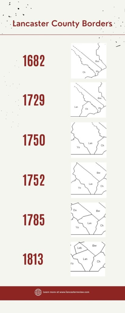
Throughout the next 80 years, the formation of our neighboring counties of York, Dauphin, Berks, and Lebanon sliced Lancaster to its present-day shape.
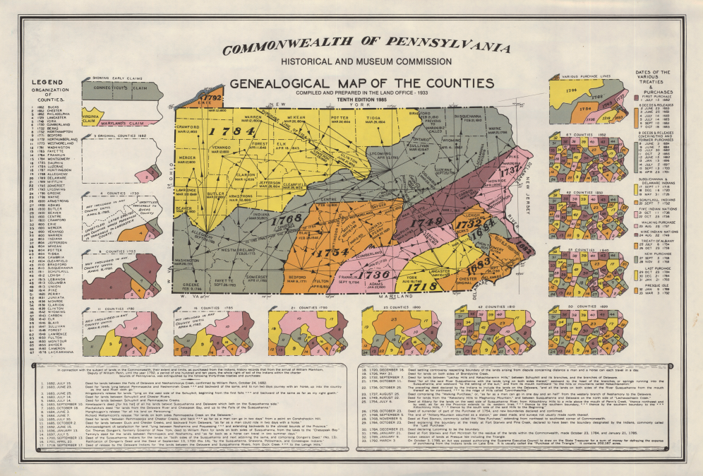
If you look at our “Lancaster County Borders” timeline, you can see the county slowly taking shape as more and more counties were added. You can view even more details with this interactive map that traces the formation of all the Pennsylvania counties.
Another helpful visual is this video by Tyler Huber. In this short video, Tyler takes a look at how the borders of Lancaster County were formed with York, Cumberland, Berks, and Chester counties.
The Mason–Dixon Line
One of the more heated debates about Lancaster’s borders was its southern border. Maryland claimed land up to modern-day Willow Street, and Pennsylvania claimed land down to the northern tip of the Chesapeake Bay. The disagreement boiled over into multiple skirmishes in the 1730s and came to be known as Cresap’s War. King George II had to intervene from across the pond, ordering a ceasefire to put an end to the fighting. A final settlement was finally achieved in 1767 after English surveyors and astronomers Charles Mason and Jeremiah Dixon surveyed the land, and the Mason–Dixon line was recognized as the permanent boundary between the two colonies.
Present Day Shape
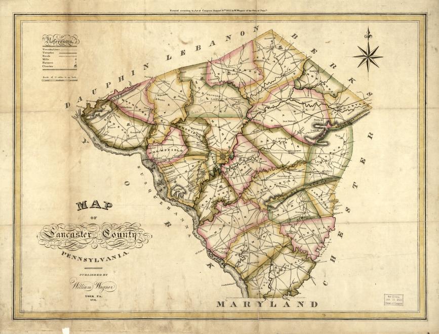
The formation of Lebanon County in 1813 was the last border change for Lancaster County, so the county borders have remained unchanged for over 200 years. This map, created in 1821 by William Wagner, is the first known map of Lancaster County with its present-day borders.
A Rich History
Lancaster County has a rich history, and the story of its borders only tells a small sliver of the story. Lancaster served as the capital of the American colonies on September 27, 1777, when the British forces captured Philadelphia, and served as the capital of Pennsylvania from 1799 to 1812. Lancaster County was also a significant destination of the Underground Railroad in the antebellum years, and the Hans Herr House, the oldest surviving dwelling of European settlers and the oldest Mennonite meetinghouse in Lancaster County, bears witness to the Anabaptists and other religious groups who migrated to Lancaster seeking religious freedom.
As we approach our nation’s Semiquincentennial, it is fascinating to reflect on the fact that Lancaster County is older than the United States. In less than four years, on May 10, 2029, Lancaster will celebrate its 300th anniversary. The history of our county is vast, but one place you can start is by looking at our borders and how Lancaster got its shape.
For more information on this topic, check out some of the great articles and resources by Adam Zurn at Uncharted Lancaster.
